Montrachet is a legendary vineyard, and while its boundaries have been fixed since 1921, some neighbouring plots and parcels are more closely related to it than others.
Thibault Morey has three plots located very close to the promised land. The first is his Batard-Montrachet, located a wall- and road-width below Domaine Leflaive’s holding in the mythical vineyard.

The second is the Chassagne-Montrachet Dent de Chien, located just above Montrachet – only a few meters above, separated by a narrow road.
And the last is the Chassagne-Montrachet Blanchot Dessus, just a few meters south of Dominique Lafon’s Montrachet. This plot had a strong link to the Montrachet vineyard before the grand cru’s current borders were finalised in 1921. It was in fact considered a part of Montrachet in the 1850s and 1860s.
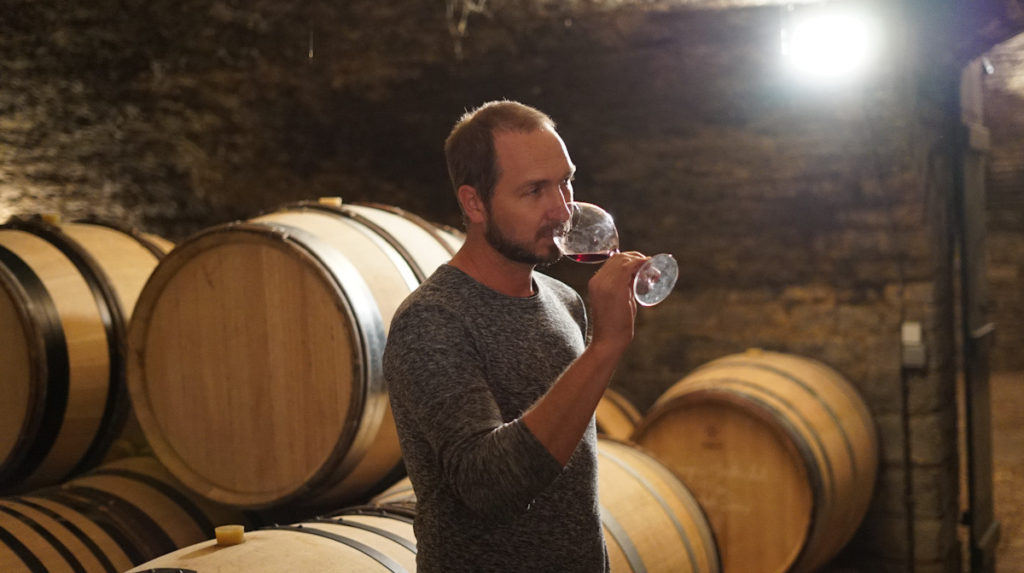
Let’s go to Morey’s Blanchot Dessus!
Montrachet now – and then
If one looks at old sources, the area and borders of the Montrachet vineyard were historically somewhat ambiguous. It was not until 1921 that Montrachet found its current size and boundaries.
Today, Montrachet is 7.998 ha, divided almost equally between Chassagne-Montrachet (3.9873 ha) and Puligny-Montrachet (4.0107 ha).
According to the literature, the size and borders were fixed in 1921 in a “legal decision” where some plots and areas were excluded from using the name “Montrachet” while others were included in the so-called “Vrai Montrachet” vineyard (vrai meaning true) as opposed to Chevalier-Montrachet, Batard-Montrachet, etc.
Before this decision, some plots outside the current vineyard also used the name, apparently based on different historical definitions of the area “Montrachet.”
According to Lavalle,1 who quotes Claude Courtépé, as far back as 1627 the terms Vrai Montrachet, Chevalier-Montrachet and Batard-Montrachet were used to describe different parts of the Montrachet area.
This explains in part the challenge different writers had in defining the vineyard in the early works on Burgundy vineyards. As Vrai Montrachet has always been considered the best and most expensive part of the area, owners have been always been keen to use that name when they sold their wines. It commanded a higher price.
This created an open door for disputes and different interpretations of the definition of Vrai Monrachet. Finally, in 1921, the issue was settled by a court ruling, ending what was presumably many decades of debate.
The court, however, was forced to examine some important questions in order to make its ruling: Which vineyards and plots were historically considered to be part of the famous Vrai Monrachet? Also – importantly – which were never really considered a part of Vrai Montrachet? One gets the impression that many plots were considered a part at some point – at least by some.
I have checked the numbers, looked at old cadastre maps, and examined books to understand these questions better, and to see which areas have been added to Montrachet over the years (see the full article here).
Montrachet according to the “1861 classification”
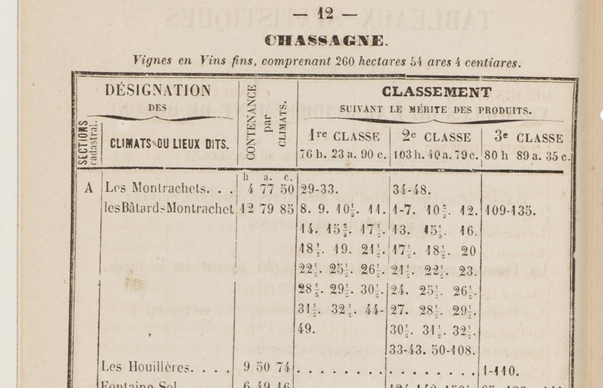
In the 1861 classification made by the Comité d’Agriculture,2 the area of the Chassagne part of Montrachet is totalled at 4.7750 ha, the plots being called Les Montrachets in the table. On the Chassagne side, plots with cadastre numbers ranging from 29 to 48 are included in the area called Montrachet (see below).
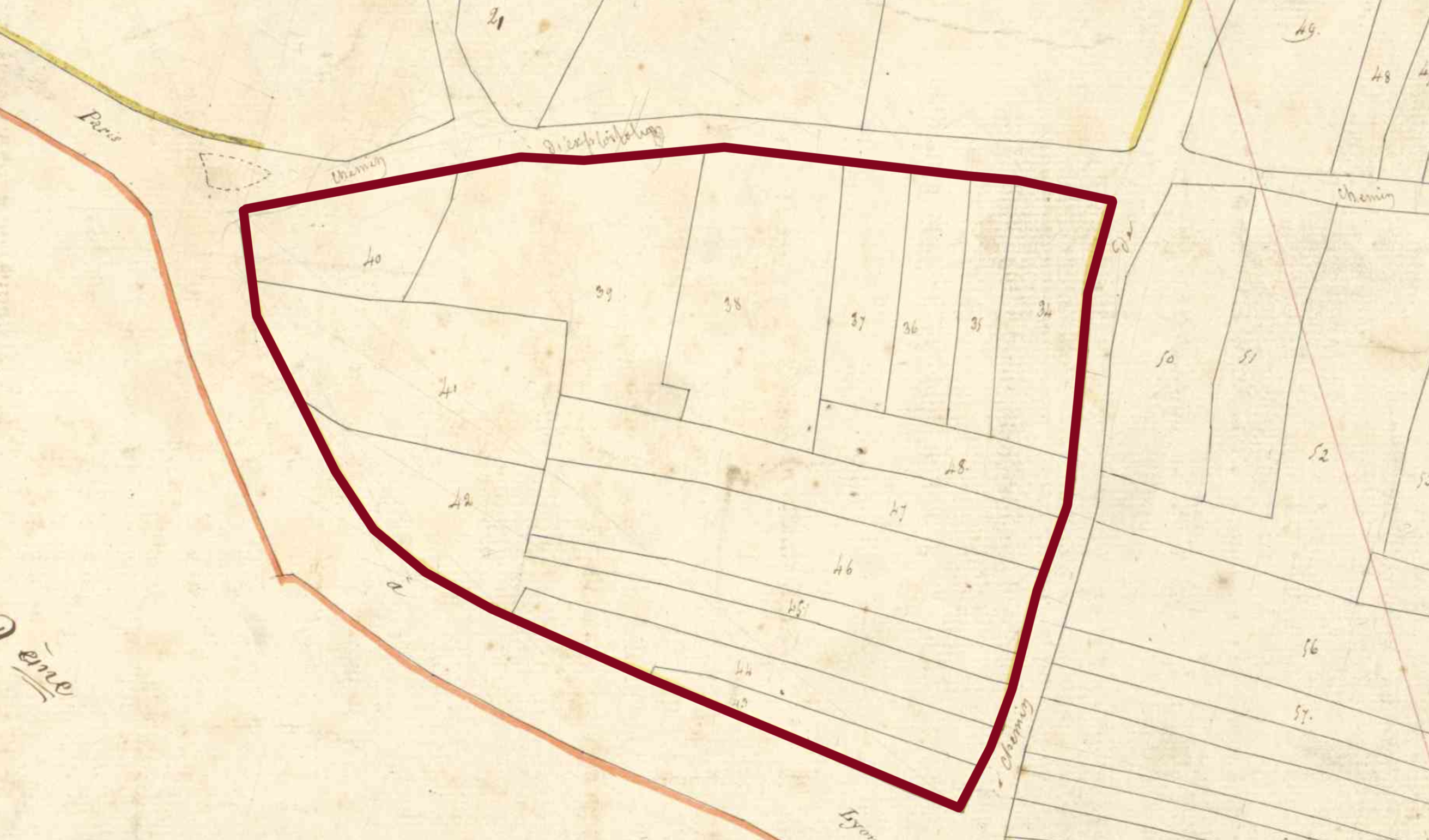
Looking at the old cadastre maps it is clear that plots 34-48 are all parcels located in the vineyard called Blanchot Dessus in the current classification (map below).
This explains why the area in the 1861 classification is larger than the current Chassagne side of Montrachet: It includes Blanchot Dessus, although it is differentiated from the best part of Montrachet by being denoted as 2e Classe, versus the rest of the Montrachet vineyard being 1re Classe.
You need to login as a Premium subscriber to read the rest of this article. If you are not a Premium Subscriber, use the subscribe function and sign-up.


 - A true vin d’émotion – a Burgundy of passion
 - A truly hedonistic wine – lively and enjoyable
 - A vivacious wine for pure indulgance
 - A potential vin d´émotion - frais et léger